Monterey Square (Savannah, Georgia)
 Looking south across the square | |
| Namesake | Battle of Monterrey |
|---|---|
| Maintained by | City of Savannah |
| Location | Savannah, Georgia, U.S. |
| Coordinates | 32°04′17″N 81°05′41″W / 32.0714°N 81.0948°W |
| North | Bull Street |
| East | East Wayne Street |
| South | Bull Street |
| West | West Wayne Street |
| Construction | |
| Completion | 1847 |
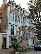
Monterey Square is one of the 22 squares of Savannah, Georgia, United States. It is located in the southernmost row of the city's five rows of squares, on Bull Street and Wayne Street, and was laid out in 1847. It is south of Madison Square, west of Taylor Square, north of Forsyth Park and east of Chatham Square. The oldest building on the square is the Herman Kuhlman Duplex, at 22–24 West Taylor Street, which dates to 1851.
Monterey Square commemorates the Battle of Monterrey (1846), in which American forces under General Zachary Taylor captured the city of Monterrey during the Mexican–American War. (The correct spelling in reference to the square is "Monterey".)
In the center of the square is an 1853 monument honoring General Casimir Pulaski.
Monterey Square is the site of Mercer House, built by Hugh Mercer and later the home of antiques dealer and conservator Jim Williams. The house (which fills an entire block) and the square itself, were featured prominently in John Berendt's 1994 true crime novel Midnight in the Garden of Good and Evil. The square has been used as a setting for several motion pictures, including the 1997 film version of Berendt's novel and The Ordeal of Dr. Mudd, starring Dennis Weaver, in 1979.[1] The Comer House, in the northeastern residential/tything block, is also featured in the movie.
The square is home to Congregation Mickve Israel, which boasts one of the few Gothic-style synagogues in America, dating from 1878.
All but one of the buildings surrounding the square are original to the square, the exception being the United Way Building at 428 Bull Street.[2]
Dedication
[edit]| Namesake | Image | Note |
|---|---|---|
| Battle of Monterrey | 
|
The square is dedicated to the United States' victory at the Battle of Monterrey, a conflict of the Mexican–American War. |
Markers and structures
[edit]| Object | Image | Note |
|---|---|---|
| Casimir Pulaski monument | 
|
In the center of the square is an 1853 monument honoring General Casimir Pulaski. The cornerstone of the monument was laid by Gilbert du Motier, Marquis de Lafayette — in Chippewa Square – in 1825. Due to financial limitations, an obelisk in Johnson Square served as a joint memorial to Nathanael Greene and Pulaski for several years. By 1852, funds had been collected to give Pulaski his own monument. The sculptor, Robert Eberhard Launitz,[3] was allowed to choose the site for the project and he had the cornerstone moved to Monterey Square.[4] Deterioration of the Pulaski monument was noted as early as 1912, and pieces began to fall in the 1990s. Restoration of the monument was completed in 2001. The body of an unknown Revolutionary soldier, speculated by some to be Pulaski himself, is said to be buried beneath Pulaski's monument.[5][4] |
| Casimir Pulaski plaque | 
|
Erected by the Georgia Historical Commission in 1954. |
| Pulaski Monument plaque | 
|
Erected by the Georgia Historical Commission in 1954. |
| Comer House/Jefferson Davis plaque | 
|
Erected by the Georgia Historical Commission in 1956. |
| Congregation Mickve Israel plaque | 
|
Erected by the Georgia Historical Commission in 1967. |
| Detail of the Pulaski Monument iron enclosure fence | 
|
The southeastern corner of the monument. |
Scudder's Row
[edit]Scudder's Row is a historic row house comprising the five homes from 1 to 9 East Gordon Street in the southeastern residential block of the square. They were built between 1852 and 1853 by brothers John and Ephraim Scudder.[6]
Constituent buildings
[edit]Each building below is in one of the eight blocks around the square composed of four residential "tything" blocks and four civic ("trust") blocks, now known as the Oglethorpe Plan. They are listed with construction years where known.
- Northwestern residential/tything block
- Herman Kuhlman Duplex, 22–24 West Taylor Street (1851)[7]
- George Gray House, 20 West Taylor Street (1855)[7] – altered in 1893
- Andrew Farie House, 18 West Taylor Street (1913)[7]
- 12 West Taylor Street (1868)[7]
- 10 West Taylor Street (1872)[7] – became the Hurn Museum in 2004
- Nicholas Cruger House, 4 West Taylor Street (1852)[7] – oldest building on the square
- Northwestern civic/trust block
- Revd. Charles W. Rogers House, 423–425 Bull Street (1858)[7] – later the home of Lee and Emma Adler
- John Lynch Building, 422 Whitaker Street (1880)[7]
- Southwestern civic/trust block
- Mercer House, 429 Bull Street (1868)[7]
- Southwestern residential/tything block
- Noble Hardee Mansion, 3 West Gordon Street (1860/1884)[8]
- 7–9 West Gordon Street (1884)[7]
- 11 West Gordon Street (1858)[7]
- John Williams Duplex, 17–19 West Gordon Street (1879–1882)
- Joachim Saussy House, 23 West Gordon Street (1870)[7]
- Northeastern residential/tything block
- Comer House, 2 East Taylor Street (1880)[7]
- William Hunter House, 10 East Taylor Street (1872)[7]
- Thomas-Levy House (western half of the Thomas-Purse Duplex),[9] 12 East Taylor Street (1869/1894)[7]
- 14 East Taylor Street (eastern half of the Thomas-Purse Duplex; 1869)[7]
- David Lopez Cohen Property (1), 16–20 East Taylor Street (1852)
- David Lopez Cohen Property (2), 24 East Taylor Street (1852)
- David Lopez Cohen Property (3), 28–32 East Taylor Street (1852)
- Southeastern civic/trust block
- Congregation Mickve Israel, 20 East Gordon Street (1878)[7]
- Southeastern residential/tything block
Gallery
[edit]-
Panoramic view of Monterey Square, facing south, 2022
-
Spanish moss in the square
-
Mercer Williams House Museum, at 429 Bull Street, occupies the entire southwestern trust lot
-
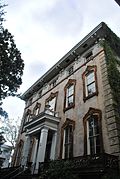
Comer House, 2 East Taylor Street
-
William Hunter House, 10 East Taylor Street
-
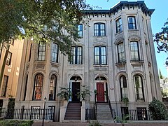
Thomas–Levy House, 12 East Taylor Street
-
14 East Taylor Street
-
David Lopez Cohen Property (1), 16–18 East Taylor Street
-
David Lopez Cohen Property (2), 24 East Taylor Street
-
David Lopez Cohen Property (3), 28–32 East Taylor Street
-
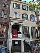
Nicholas Cruger House, 4 West Taylor Street
-
Hurn Museum, 10 West Taylor Street
-
12 West Taylor Street
-
Andrew Farie House, 18 West Taylor Street
-
George Gray House, 20 West Taylor Street
-
Herman Kuhlman Duplex, 22–24 West Taylor Street
-
John Williams Duplex, 17–19 West Gordon Street
-
Congregation Mickve Israel, 20 East Gordon Street
-
Revd. Charles W. Rogers House, 423–425 Bull Street
-
11 East Gordon Street
-
Charles McGill House, 15 East Gordon Street
-
John Rowland House, 17–19 East Gordon Street
-
Frederick Groschaud House, 23 East Gordon Street
-
Noble Hardee Mansion, 3 West Gordon Street
-
7–9 West Gordon Street
-
11 West Gordon Street, designed by John S. Norris
-
Joachim Saussy House, 23 West Gordon Street
-
John Lynch Building, 422 Whitaker Street
References
[edit]- ^ Bardsley, Marilyn J. (2012-12-14). After Midnight in the Garden of Good and Evil. Rosetta Books. ISBN 978-0-7953-3343-9.
- ^ City of Savannah's Savannah's Squares page, accessed June 13, 2007.
- ^ Chisholm, Hugh, ed. (1911). . Encyclopædia Britannica (11th ed.). Cambridge University Press.
- ^ a b City of Savannah's monuments page This page links directly to numerous short entries, many accompanied by photographs, discussing a variety of monuments, memorials, etc., in the squares and elsewhere. Accessed June 16, 2007.
- ^ See Savannah by T.D. Conner (2001), accessed June 14, 2007
- ^ Savannah, Immortal City: Volume One of the Civil War Savannah Series - Barry Sheehy, Cindy Wallace, Vaughnette Goode-Walker (2011), p. 329
- ^ a b c d e f g h i j k l m n o p q Historic Building Map: Savannah Historic District – Historic Preservation Department of the Chatham County-Savannah Metropolitan Planning Commission (November 17, 2011), p. 65
- ^ a b c d e f Historic Building Map: Savannah Historic District – Historic Preservation Department of the Chatham County-Savannah Metropolitan Planning Commission (November 17, 2011), p. 66
- ^ "Jane Fishman: To John Duncan, history is life" – Savannah Morning News, March 23, 2019


